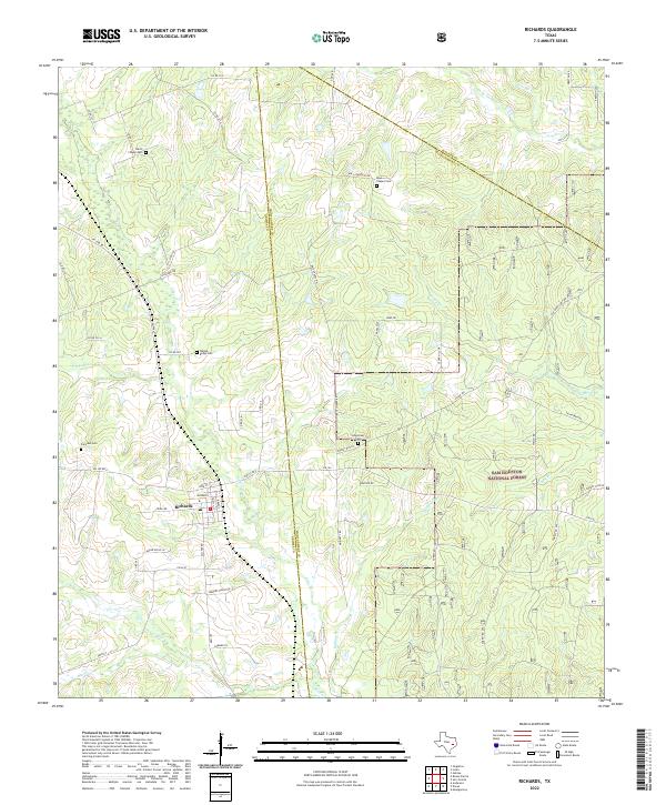
2022 Map of Richards
USGS Topo · Published 2022About this map
The community of Richards anchors this part of east Texas, where the local economy and landscape are shaped by the sprawling timberlands of the Sam Houston National Forest. This 2022 survey captures a rural environment marked by numerous family and community burial grounds, including Bays Chapel Cem, Longstreet Cem, and Walnut Ridge Cem, which serve as vital markers for local genealogical research. The terrain is defined by a dense network of small waterways like Lake Creek and Flagtail Creek that cut through the wooded forest tracts and ranch lands. In the western portion, the landscape transitions into established agricultural areas such as Sanders Ranch Rd, while the eastern half remains largely dedicated to the national forest. Small roads like County Road 233 and FM 1486 Road provide the primary access through these timbered uplands and creek bottoms.
Find a feature on this map
59 named features on this map. Tap any name to fly to it.
Don’t see what you’re looking for? This feature index may not catch every label — zoom into the map to look around manually.
Map Details
Editions of this 2022 Richards Map
This is the sole edition of this map. No revisions or reprints were ever made.
Other maps of this area

1954 · Beaumont
USGS Topo · 1:250,000

1957 · Beaumont
USGS Topo · 1:250,000

1959 · San Jacinto
USGS Topo · 1:24,000

1959 · Montgomery
USGS Topo · 1:24,000

1961 · Anderson
USGS Topo · 1:24,000

1961 · Singleton
USGS Topo · 1:24,000

1962 · Dacus
USGS Topo · 1:24,000

1962 · Richards
USGS Topo · 1:24,000
1962 · Roans Prairie
USGS Topo · 1:24,000

1962 · Galilee
USGS Topo · 1:24,000