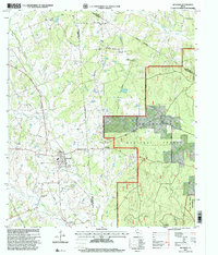
1997 Map of Richards
USGS Topo · Published 2000About this map
The town of Richards anchors this landscape, situated at the intersection of a Burlington Northern Santa Fe rail line and several key local roads. The area's history is reflected in its numerous small communities and burial sites, including Longstreet, Fairview Cemetery, and Bunn No 2 Cemetery. The eastern portion of the map is dominated by the protected timberlands of the Sam Houston National Forest, including the Little Lake Creek Wilderness. Natural water features like Lake Creek, Garretts Creek, and West Sandy Creek drain the terrain, which rises to landmarks such as Robinson Hill. The map documents a rural Texas environment where mid-century infrastructure like a Pumping Station and multiple quarries coexist with long-standing religious and social hubs such as Bays Chapel and Robinson Hill Church.
Find a feature on this map
34 named features on this map. Tap any name to fly to it.
Don’t see what you’re looking for? This feature index may not catch every label — zoom into the map to look around manually.
Map Details
Editions of this 1997 Richards Map
This is the sole edition of this map. No revisions or reprints were ever made.
Other maps of this area

1954 · Beaumont
USGS Topo · 1:250,000

1957 · Beaumont
USGS Topo · 1:250,000

1959 · San Jacinto
USGS Topo · 1:24,000

1959 · Montgomery
USGS Topo · 1:24,000

1961 · Anderson
USGS Topo · 1:24,000

1961 · Singleton
USGS Topo · 1:24,000

1962 · Dacus
USGS Topo · 1:24,000

1962 · Richards
USGS Topo · 1:24,000
1962 · Roans Prairie
USGS Topo · 1:24,000

1962 · Galilee
USGS Topo · 1:24,000