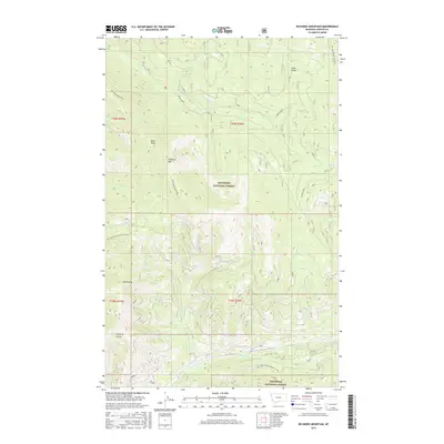
2017 Map of Richards Mountain
USGS Topo · Published 2017About this map
Kootenai National Forest lands dominate this high-altitude landscape in Lincoln County, where dramatic elevation changes define the local hydrography. The topography is anchored by Richards Mountain and Mt Sterling, with a network of drainages such as Backus Creek and Dunn Creek carving through the steep terrain. A notable cultural landmark is the Sugarloaf Lookout positioned on a ridge in the northeastern sector, reflecting the region's long history of fire observation and forest management. The map reveals the intricate system of access routes required for this environment, including the Natl Forest Develop Road 4596 Rd. Drainage patterns like Wuoma Cr and Sterling Gulch illustrate how seasonal runoff flows from peaks like Dunn Peak toward the larger valley systems.
Find a feature on this map
23 named features on this map. Tap any name to fly to it.
Don’t see what you’re looking for? This feature index may not catch every label — zoom into the map to look around manually.
Map Details
Editions of this 2017 Richards Mountain Map
This is the sole edition of this map. No revisions or reprints were ever made.
Other maps of this area

1920 · Jennings
USGS Topo · 1:125,000

1935 · Thompson Lakes
USGS Topo · 1:96,000

1942 · Thompson Lakes
USGS Topo · 1:125,000

1957 · Kalispell
USGS Topo · 1:250,000

1960 · Kalispell
USGS Topo · 1:250,000

1961 · Kalispell
USGS Topo · 1:250,000

1963 · Wolf Prairie
USGS Topo · 1:24,000

1963 · Warland Peak
USGS Topo · 1:24,000

1963 · Cripple Horse Mountain
USGS Topo · 1:24,000
1963 · Tony Peak
USGS Topo · 1:24,000