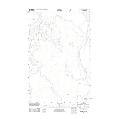
2011 Map of Richards Peak
USGS Topo · Published 2011About this map
Richards Peak stands as the central landmark of this high-elevation terrain in Sanders County, defined by a complex drainage system and open meadows. The eastern boundary is shaped by the Thompson River, which winds south toward Hell Roaring Canyon and is paralleled by the Thompson River County Rd. These watercourses create a distinct network of creek valleys, including Meadow Creek and Fishtrap Creek, which have historically facilitated movement through this mountain landscape.
Find a feature on this map
19 named features on this map. Tap any name to fly to it.
Don’t see what you’re looking for? This feature index may not catch every label — zoom into the map to look around manually.
Map Details
Editions of this 2011 Richards Peak Map
This is the sole edition of this map. No revisions or reprints were ever made.
Other maps of this area

1937 · Thompson Falls
USGS Topo · 1:125,000

1956 · Wallace
USGS Topo · 1:250,000

1960 · Wallace
USGS Topo · 1:250,000

1964 · Calico Creek
USGS Topo · 1:24,000
1964 · Priscilla Peak
USGS Topo · 1:24,000
1964 · Cook Mountain
USGS Topo · 1:24,000
1964 · Shroder Creek
USGS Topo · 1:24,000
1964 · Loneman Creek
USGS Topo · 1:24,000
1966 · Bend
USGS Topo · 1:24,000
1966 · Mantrap Fork
USGS Topo · 1:24,000