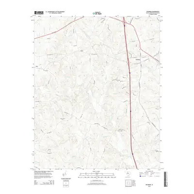
2014 Map of Richburg
USGS Topo · Published 2014About this map
Richburg serves as the central hub of this Chester County landscape, where the modern interstate corridor intersects with older thoroughfares like the Lancaster Hwy. The settlement pattern reveals a mix of small communities including Orrs and Knox, connected by a network of rural routes such as Old Richburg Rd and Peden Bridge Rd. To the west, the Chester Lookout Tower stands as a prominent landmark overlooking the drainage basins of Rocky Creek and Bull Skin Creek. Genealogists will find significant value in the documentation of local burial sites, including Mt Moriah Cem, the Anderson Cemetery, and the William Martin Cemetery, which provide tangible links to the area's family histories. Educational infrastructure is anchored by Lewisville High School, while the terrain is further defined by crossings like Pedens Bridge and the winding course of Beaverdam Creek.
Find a feature on this map
67 named features on this map. Tap any name to fly to it.
Don’t see what you’re looking for? This feature index may not catch every label — zoom into the map to look around manually.
Map Details
Editions of this 2014 Richburg Map
This is the sole edition of this map. No revisions or reprints were ever made.
Other maps of this area

1941 · Spartanburg
USGS Topo · 1:250,000

1949 · Rock Hill
USGS Topo · 1:62,500

1953 · Spartanburg
USGS Topo · 1:250,000

1960 · Spartanburg
USGS Topo · 1:250,000

1963 · Spartanburg
USGS Topo · 1:250,000

1964 · Spartanburg
USGS Topo · 1:250,000

1968 · Catawba
USGS Topo · 1:24,000

1968 · Blackstock
USGS Topo · 1:24,000
1969 · Fort Lawn
USGS Topo · 1:24,000
1969 · Great Falls
USGS Topo · 1:24,000