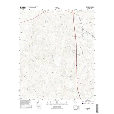
2017 Map of Richburg
USGS Topo · Published 2017About this map
Richburg serves as the primary hub in this portion of Chester County, situated at a junction of regional transit corridors. The settlement pattern reflects the area's agricultural and rural history, with smaller nodes like Knox and Orrs punctuating the landscape. Significant for genealogists and local historians are the scattered burial grounds, including the Mount Moriah Cem, Anderson Cem, and William Martin Cem, which provide a record of early families in the district.
Find a feature on this map
56 named features on this map. Tap any name to fly to it.
Don’t see what you’re looking for? This feature index may not catch every label — zoom into the map to look around manually.
Map Details
Editions of this 2017 Richburg Map
This is the sole edition of this map. No revisions or reprints were ever made.
Other maps of this area

1941 · Spartanburg
USGS Topo · 1:250,000

1949 · Rock Hill
USGS Topo · 1:62,500

1953 · Spartanburg
USGS Topo · 1:250,000

1960 · Spartanburg
USGS Topo · 1:250,000

1963 · Spartanburg
USGS Topo · 1:250,000

1964 · Spartanburg
USGS Topo · 1:250,000

1968 · Catawba
USGS Topo · 1:24,000

1968 · Blackstock
USGS Topo · 1:24,000
1969 · Fort Lawn
USGS Topo · 1:24,000
1969 · Great Falls
USGS Topo · 1:24,000