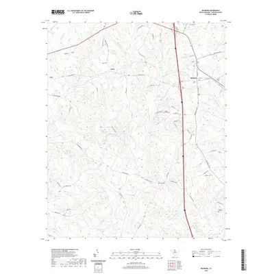
2020 Map of Richburg
USGS Topo · Published 2020About this map
Richburg and its surrounding Chester County landscape are defined by a network of dendritic stream systems and rural crossroads. The terrain is deeply carved by watercourses like Rocky Creek, Bull Skin Cr, and Hooper Cr, which create a complex topography of ridges and draws. Small settlements such as Orrs, Knox, and Pedens Bridge mark historic collection points for local commerce and transit. For genealogists, the map identifies several significant burial grounds, including Mount Moriah Cem near Barbers Cr and the William Martin Cem in the southeastern quadrant. The transportation layout shows a transition from traditional routes like Old Richburg Rd to modern corridors, illustrating how the region's accessibility has evolved while maintaining its agricultural and residential character.
Find a feature on this map
60 named features on this map. Tap any name to fly to it.
Don’t see what you’re looking for? This feature index may not catch every label — zoom into the map to look around manually.
Map Details
Editions of this 2020 Richburg Map
This is the sole edition of this map. No revisions or reprints were ever made.
Other maps of this area

1941 · Spartanburg
USGS Topo · 1:250,000

1949 · Rock Hill
USGS Topo · 1:62,500

1953 · Spartanburg
USGS Topo · 1:250,000

1960 · Spartanburg
USGS Topo · 1:250,000

1963 · Spartanburg
USGS Topo · 1:250,000

1964 · Spartanburg
USGS Topo · 1:250,000

1968 · Catawba
USGS Topo · 1:24,000

1968 · Blackstock
USGS Topo · 1:24,000
1969 · Fort Lawn
USGS Topo · 1:24,000
1969 · Great Falls
USGS Topo · 1:24,000