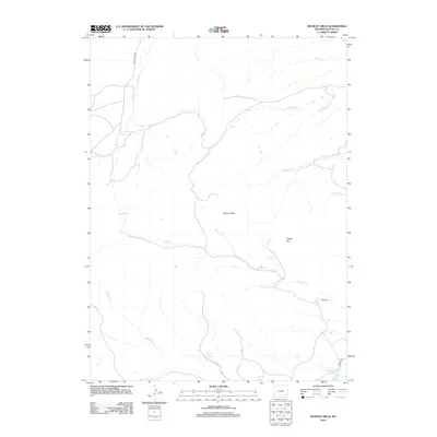
2012 Map of Richeau Hills
USGS Topo · Published 2012About this map
Richeau Hills defines this corner of Platte County, where a network of seasonal drainages and springs supported ranching life in the early 21st century. The map centers on the elevation of Squaw Hill and the winding course of Maxwell Cr, illustrating a landscape structured by water access. Long-established holdings like Hill Ranch and the vital Home Ranch Spring anchor the southeastern portion of the quadrangle, while Richard Reservoir Number 1 provides a modern look at regional water management. These features, along with a series of creeks including Hunton Cr and Brush Cr, trace the drainage patterns of the high plains. Grounded in 2012 data, the survey details the limited road network connecting these remote sites, notably Brush Creek Rd and Diamond Rd.
Find a feature on this map
14 named features on this map. Tap any name to fly to it.
Don’t see what you’re looking for? This feature index may not catch every label — zoom into the map to look around manually.
Map Details
Editions of this 2012 Richeau Hills Map
This is the sole edition of this map. No revisions or reprints were ever made.
Other maps of this area

1953 · Natwick SW
USGS Topo · 1:24,000

1953 · Double L Ranch
USGS Topo · 1:24,000

1953 · Natwick
USGS Topo · 1:24,000

1953 · Squaw Rock
USGS Topo · 1:24,000

1953 · Ferguson Corner
USGS Topo · 1:24,000

1953 · Richeau Hills
USGS Topo · 1:24,000

1954 · Cheyenne
USGS Topo · 1:250,000

1958 · Cheyenne
USGS Topo · 1:250,000

1962 · Delano Ranch
USGS Topo · 1:24,000

1962 · Mc Donald Ranch
USGS Topo · 1:24,000