
1953 Map of Squaw Rock
USGS Topo · Published 1954About this map
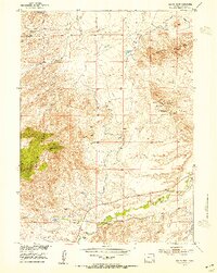
Mining operations and water management systems define this mid-century look at the Wyoming landscape. The Cooney Hills rise in the northeast, where prospectors worked the Precious Honor Mine No 1 and Precious Honor Mine No 2, alongside several other inactive sites. This survey, conducted for the development of the Missouri River Basin, reveals a complex network of drainage and irrigation, from the Laramie River in the north to the Sybille Creek in the south. A significant piece of infrastructure, the Wyoming Development Company Canal No 1, cuts through the northern hills, illustrating the era's focus on reclaiming arid lands for agricultural use. The prominent heights of Squaw Mountain and Squaw Rock provide topographic anchors for the surrounding drainages of Reed Creek and McMurray Creek.
Find a feature on this map
17 named features on this map. Tap any name to fly to it.
Don’t see what you’re looking for? This feature index may not catch every label — zoom into the map to look around manually.
Map Details
Editions of this 1953 Squaw Rock Map
3 editions found
Other maps of this area

1953 · Natwick SW
USGS Topo · 1:24,000

1953 · Hightower
USGS Topo · 1:24,000

1953 · Natwick
USGS Topo · 1:24,000

1953 · Hightower SW
USGS Topo · 1:24,000

1953 · Richeau Hills
USGS Topo · 1:24,000

1954 · Torrington
USGS Topo · 1:250,000

1954 · Cheyenne
USGS Topo · 1:250,000

1955 · Poe Mountain
USGS Topo · 1:24,000

1955 · Moonshine Peak
USGS Topo · 1:24,000

1958 · Cheyenne
USGS Topo · 1:250,000