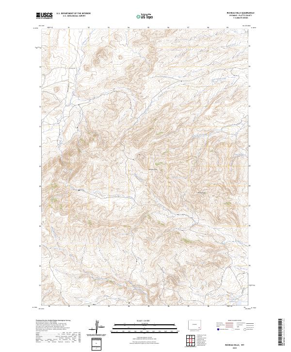
2023 Map of Richeau Hills
USGS Topo · Published 2023About this map
The Richeau Hills dominate the center of this Wyoming quadrangle, where a complex network of seasonal drainages and creek beds shapes the high plains landscape. At the heart of this cattle-ranching country, Home Ranch Spring provides a vital water source near the junction of several drainages. The map reveals a remote and arid terrain where water management is evident in features like Richard Reservoir Number 1 in the southeastern corner.
Find a feature on this map
17 named features on this map. Tap any name to fly to it.
Don’t see what you’re looking for? This feature index may not catch every label — zoom into the map to look around manually.
Map Details
Editions of this 2023 Richeau Hills Map
This is the sole edition of this map. No revisions or reprints were ever made.
Other maps of this area

1953 · Natwick SW
USGS Topo · 1:24,000

1953 · Double L Ranch
USGS Topo · 1:24,000

1953 · Natwick
USGS Topo · 1:24,000

1953 · Squaw Rock
USGS Topo · 1:24,000

1953 · Ferguson Corner
USGS Topo · 1:24,000

1953 · Richeau Hills
USGS Topo · 1:24,000

1954 · Cheyenne
USGS Topo · 1:250,000

1958 · Cheyenne
USGS Topo · 1:250,000

1962 · Delano Ranch
USGS Topo · 1:24,000

1962 · Mc Donald Ranch
USGS Topo · 1:24,000