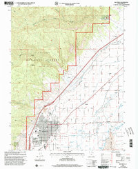
2001 Map of Richfield
USGS Topo · Published 2003About this map
Agricultural water management and rugged forest terrain define the Sevier Valley at the dawn of the 21st century. The central corridor is dominated by the Sevier River and a sophisticated network of irrigation infrastructure including the Piute Canal, Richfield Canal, and Vermilion Canal, which sustain the valley's productivity. These waterways wrap around the expanding city of Richfield, where the Fairground, Athletic Field, and several residential Mobile Home Park sites are clearly mapped. Smaller rural settlements like Venice, Prattsville, and Kema dot the river plain, while the western landscape rises sharply into the Fish Lake National Forest. The mountain slopes around Table Mountain are marked with small-scale mineral interests shown by multiple prospects and specialized features such as a Flume and numerous flowing wells, illustrating the region's reliance on managed natural resources.
Find a feature on this map
49 named features on this map. Tap any name to fly to it.
Don’t see what you’re looking for? This feature index may not catch every label — zoom into the map to look around manually.
Map Details
Editions of this 2001 Richfield Map
This is the sole edition of this map. No revisions or reprints were ever made.
Other maps of this area

1885 · Beaver
USGS Topo · 1:250,000

1885 · Fish Lake
USGS Topo · 1:250,000

1896 · Fish Lake
USGS Topo · 1:250,000

1940 · Monroe
USGS Topo · 1:62,500

1944 · Monroe
USGS Topo · 1:62,500

1953 · Richfield
USGS Topo · 1:250,000

1956 · Salina
USGS Topo · 1:250,000

1958 · Richfield
USGS Topo · 1:250,000

1960 · Salina
USGS Topo · 1:250,000

1961 · Mt. Catherine
USGS Topo · 1:24,000