
1943 Map of Richfield Springs
USGS Topo · Published 1960About this map
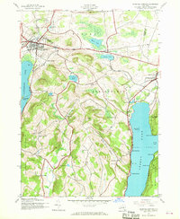
Richfield Springs serves as the primary hub of this 1943 survey, situated where the D L & W railroad corridor meets the northern tip of Canadarago Lake. The landscape is a mix of agricultural uplands and wetlands, such as Maumee Swamp and Weaver Lake, which drain toward the larger basins. The settlement pattern here is deeply rooted in the rural school district system, with numerous numbered schoolhouses including School No 11 and School No 15 serving isolated hamlets like Taylortown and Pierstown.
Find a feature on this map
60 named features on this map. Tap any name to fly to it.
Don’t see what you’re looking for? This feature index may not catch every label — zoom into the map to look around manually.
Map Details
Editions of this 1943 Richfield Springs Map
2 editions found
Other maps of this area

1903 · Richfield Springs
USGS Topo · 1:62,500

1907 · Winfield
USGS Topo · 1:62,500

1907 · Cooperstown
USGS Topo · 1:62,500

1909 · Cooperstown
USGS Topo · 1:62,500

1910 · Hartwick
USGS Topo · 1:62,500

1912 · Hartwick
USGS Topo · 1:62,500

1943 · Schuyler Lake
USGS Topo · 1:24,000

1943 · Jordanville
USGS Topo · 1:24,000

1943 · Westford
USGS Topo · 1:24,000
1943 · East Springfield
USGS Topo · 1:24,000