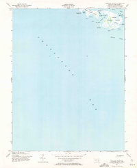
1942 Map of Richland Point
USGS Topo · Published 1971About this map
Lower Hooper Island and the southern tip of Middle Hooper Island anchor this coastal survey, where the terrestrial landscape is entirely dictated by the surrounding waters of the Chesapeake Bay and the Honga River. The mapping, based on 1942 aerial photography and planetable work, reveals a delicate chain of points and coves along the Eastern Shore. Notable for genealogists is the inclusion of Mens Burial Pt, a specific landing and cemetery site on the eastern edge of the lower island. The narrow, marshy topography is punctuated by family-named landmarks such as Applegarth and Billys Pt, illustrating how early 20th-century life here was inextricably linked to the tides of the Hooper Strait and internal waterways like The Thorofare.
Find a feature on this map
25 named features on this map. Tap any name to fly to it.
Don’t see what you’re looking for? This feature index may not catch every label — zoom into the map to look around manually.
Map Details
Editions of this 1942 Richland Point Map
2 editions found

Other maps of this area

1892 · Drum Point
USGS Topo · 1:62,500

1894 · Point Lookout
USGS Topo · 1:62,500

1898 · St. Marys
USGS Topo · 1:125,000

1901 · Drum Point
USGS Topo · 1:62,500

1903 · Bloodsworth Island
USGS Topo · 1:62,500

1905 · Crapo
USGS Topo · 1:62,500

1905 · Drum Point
USGS Topo · 1:62,500

1906 · St. Marys
USGS Topo · 1:125,000

1912 · Point Lookout
USGS Topo · 1:62,500

1937 · Point Lookout
USGS Topo · 1:62,500