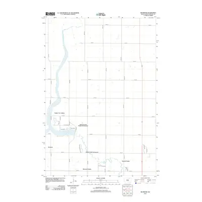
2012 Map of Richmond
USGS Topo · Published 2012About this map
Richmond Lake serves as the central anchor for this part of Brown County, where the landscape is defined by modern residential expansion along the water's edge. This 2012 survey illustrates a series of organized housing pockets including Bieglers First Addition, Richmond Lake Heights Development, and Richmond Heights. The road network, consisting of a precise grid of numeric routes like 122nd St and 384th Ave, transitions into more winding local drives such as W Shore Dr and E Shore Dr as they approach the shoreline. Farther south, Pleasant Vally Development and Richfield Heights show the continued southward pull of settlement toward the outskirts of the region's larger population centers. The presence of Spillway Dr and Youth Camp Rd suggests the lake's dual role as both a managed water resource and a recreational hub for the surrounding community.
Find a feature on this map
34 named features on this map. Tap any name to fly to it.
Don’t see what you’re looking for? This feature index may not catch every label — zoom into the map to look around manually.
Map Details
Editions of this 2012 Richmond Map
This is the sole edition of this map. No revisions or reprints were ever made.
Other maps of this area

1894 · Columbia
USGS Topo · 1:62,500

1895 · Aberdeen
USGS Topo · 1:125,000

1896 · Columbia
USGS Topo · 1:125,000

1899 · Ellendale
USGS Topo · 1:125,000

1899 · Northville
USGS Topo · 1:125,000

1952 · Ordway
USGS Topo · 1:24,000

1952 · Westport
USGS Topo · 1:24,000

1952 · Richmond NE
USGS Topo · 1:24,000

1954 · Aberdeen
USGS Topo · 1:250,000

1956 · Aberdeen
USGS Topo · 1:250,000
Featured Places
- Mercier Township, SD
- Lincoln Township, SD
- Ravinia Township, SD
- Carlisle Township, SD
- Westport Township, SD