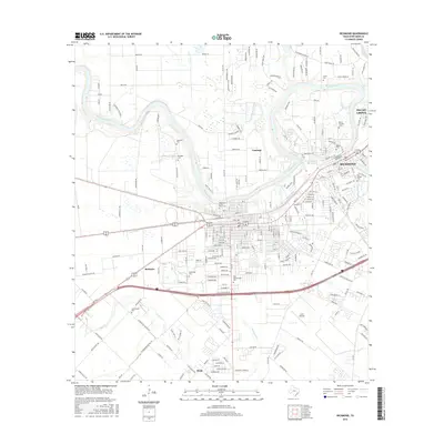
2016 Map of Richmond
USGS Topo · Published 2016About this map
The Brazos River meanders through this portion of Fort Bend County, defining the landscape between the established centers of Richmond and the neighboring residential growth of Pecan Grove. This 2016 survey documents the modern suburban footprint alongside numerous small, family and community burial grounds that reflect the area's deep roots. Genealogists will find a high density of sites including Morton Cem, Lightfoot Cem, and the West Gethsemane Cem. The map tracks the convergence of major infrastructure, such as the Hwy 59 Frontage Rd, with older water systems like Rabbs Bayou and the Assoc Canal. Smaller settlements like McHattie and Pleak appear amidst a transition from municipal grids to the open reaches around Lane Airpark, providing a clear view of how development has integrated with the local creek systems like Seabourne Cr and Coon Cr.
Find a feature on this map
23 named features on this map. Tap any name to fly to it.
Don’t see what you’re looking for? This feature index may not catch every label — zoom into the map to look around manually.
Map Details
Editions of this 2016 Richmond Map
This is the sole edition of this map. No revisions or reprints were ever made.
Other maps of this area

1915 · Clodine
USGS Topo · 1:24,000

1919 · Clodine
USGS Topo · 1:31,680

1950 · Houston
USGS Topo · 1:250,000

1953 · Needville
USGS Topo · 1:24,000

1953 · Lake George
USGS Topo · 1:24,000

1953 · Kendleton
USGS Topo · 1:24,000

1955 · Sugar Land
USGS Topo · 1:62,500

1955 · Richmond
USGS Topo · 1:62,500

1956 · Houston
USGS Topo · 1:250,000
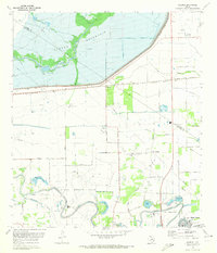
1970 · Clodine
USGS Topo · 1:24,000