
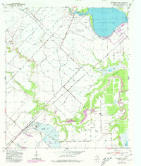
1953 Map of Lake George
USGS Topo · Published 1954About this map
The Big Creek Oil Field and the Sulphur Field define the industrial landscape of this Texas Gulf Coast region in the early 1950s. Located near Whaley Corner, the terrain is marked by an extensive system of man-made structures including numerous Levee lines and Evaporating Ponds that reflect the area's intensive mineral extraction and water management. The settlement of Long Point, featuring the Long Point School, serves as a local hub near the southern oil operations.
Find a feature on this map
18 named features on this map. Tap any name to fly to it.
Don’t see what you’re looking for? This feature index may not catch every label — zoom into the map to look around manually.
Map Details
Editions of this 1953 Lake George Map
3 editions found
Other maps of this area

1950 · Houston
USGS Topo · 1:250,000

1953 · Needville
USGS Topo · 1:24,000

1953 · Guy
USGS Topo · 1:24,000

1953 · Damon
USGS Topo · 1:24,000

1953 · Otey
USGS Topo · 1:24,000

1953 · Thompsons
USGS Topo · 1:24,000

1955 · Sugar Land
USGS Topo · 1:62,500

1955 · Richmond
USGS Topo · 1:62,500

1956 · Houston
USGS Topo · 1:250,000
1970 · Sugar Land
USGS Topo · 1:24,000