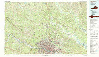
1984 Map of Richmond
USGS Topo · Published 1989About this map
The James River and its major tributaries, including the South Anna River and the Appomattox River, converge in this 1980s topographic study of Central Virginia. The cityscape of Richmond is the focal point, surrounded by suburban and rural communities like Mechanicsville, Lakeside, and Highland Springs. The map illustrates a landscape of deep historical significance, notably showing the sprawling reaches of the Richmond National Battlefield Park and the prominent Hollywood Cem overlooking the river.
Find a feature on this map
42 named features on this map. Tap any name to fly to it.
Don’t see what you’re looking for? This feature index may not catch every label — zoom into the map to look around manually.
Map Details
Editions of this 1984 Richmond Map
3 editions found
Other maps of this area

1887 · Spottsylvania
USGS Topo · 1:125,000

1889 · Fredericksburg
USGS Topo · 1:125,000

1890 · Goochland
USGS Topo · 1:125,000

1891 · Palmyra
USGS Topo · 1:125,000

1891 · Farmville
USGS Topo · 1:125,000

1892 · Fredericksburg
USGS Topo · 1:125,000

1892 · Spottsylvania
USGS Topo · 1:125,000

1892 · Goochland
USGS Topo · 1:125,000

1892 · Montross
USGS Topo · 1:62,500

1892 · Gordonsville
USGS Topo · 1:125,000