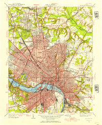
1934 Map of Richmond
USGS Topo · Published 1954About this map
James River frontage and the intricate urban grid of Virginia's capital define this 1930s-era survey. The map details a city shaped by its deep history and diverse institutions, from the Confederate Soldiers Home to Virginia Union University. The landscape is a mix of dense residential wards and significant burial grounds, including the riverfront Hollywood Cemetery and Maury Cemetery south of the water.
Find a feature on this map
91 named features on this map. Tap any name to fly to it.
Don’t see what you’re looking for? This feature index may not catch every label — zoom into the map to look around manually.
Map Details
Editions of this 1934 Richmond Map
2 editions found
Other maps of this area

1890 · Goochland
USGS Topo · 1:125,000

1892 · Goochland
USGS Topo · 1:125,000

1894 · Bermuda Hundred
USGS Topo · 1:62,500

1894 · Richmond
USGS Topo · 1:62,500

1895 · Richmond
USGS Topo · 1:62,500

1897 · Amelia
USGS Topo · 1:125,000

1934 · Seven Pines
USGS Topo · 1:24,000

1934 · Richmond
USGS Topo · 1:24,000

1936 · Richmond West
USGS Topo · 1:24,000

1936 · Glen Allen
USGS Topo · 1:24,000