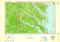
1959 Map of Richmond
USGS Topo · Published 1959About this map
Richmond sits at the head of navigation on the James River, serving as a central hub for major rail lines including the Richmond Fredericksburg & Potomac RR and the Chesapeake & Ohio Ry. The mid-century landscape is defined by the heavy military presence in the Tidewater and Piedmont regions, anchored by installations such as Camp Pickett near Blackstone and Fort Monroe overlooking the entrance to the Chesapeake Bay.
Find a feature on this map
146 named features on this map. Tap any name to fly to it.
Don’t see what you’re looking for? This feature index may not catch every label — zoom into the map to look around manually.
Map Details
Editions of this 1959 Richmond Map
This is the sole edition of this map. No revisions or reprints were ever made.
Other maps of this area

1887 · Spottsylvania
USGS Topo · 1:125,000

1889 · Fredericksburg
USGS Topo · 1:125,000

1890 · Goochland
USGS Topo · 1:125,000

1891 · Palmyra
USGS Topo · 1:125,000

1891 · Farmville
USGS Topo · 1:125,000

1892 · Fredericksburg
USGS Topo · 1:125,000

1892 · Spottsylvania
USGS Topo · 1:125,000

1892 · Goochland
USGS Topo · 1:125,000

1892 · Piney Point
USGS Topo · 1:62,500

1892 · Montross
USGS Topo · 1:62,500