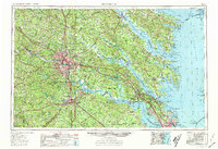
1973 Map of Richmond
USGS Topo · Published 1974About this map
The State Capitol anchors this detailed survey of Eastern Virginia, where the urban density of Richmond and Petersburg gives way to the tidal landscapes of the Middle Peninsula and Northern Neck. This era of mapping shows the established interstate system, including Interstate 95 and Interstate 64, cutting through a region defined by its deep colonial roots and significant military presence. Major installations like the Fort Lee Mil Res, Fort Eustis Mil Res, and Langley AFB are clearly delineated alongside preserved lands such as the Colonial Nat Hist Pk.
Find a feature on this map
131 named features on this map. Tap any name to fly to it.
Don’t see what you’re looking for? This feature index may not catch every label — zoom into the map to look around manually.
Map Details
Editions of this 1973 Richmond Map
2 editions found
Other maps of this area

1887 · Spottsylvania
USGS Topo · 1:125,000

1889 · Fredericksburg
USGS Topo · 1:125,000

1890 · Goochland
USGS Topo · 1:125,000

1891 · Palmyra
USGS Topo · 1:125,000

1891 · Farmville
USGS Topo · 1:125,000

1892 · Fredericksburg
USGS Topo · 1:125,000

1892 · Spottsylvania
USGS Topo · 1:125,000

1892 · Goochland
USGS Topo · 1:125,000

1892 · Piney Point
USGS Topo · 1:62,500

1892 · Montross
USGS Topo · 1:62,500