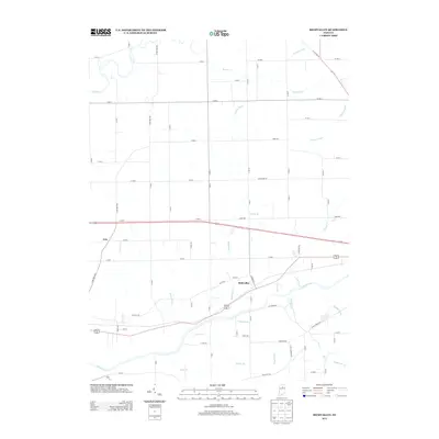
2013 Map of Richvalley
USGS Topo · Published 2013About this map
The Wabash River and the Eel River define the northern and southern bounds of this Wabash County landscape, creating a fertile corridor historically significant for both transit and agriculture. Between these two major waterways, a complex network of drainage and creek systems such as Bachelor Cr and Johnson Ditch illustrates the extensive land management required to maintain the region's productive farm fields. The small settlement of Richvalley sits along the southern bank, positioned near the confluence of Engleman Cr and the Wabash River. To the northwest, the map documents the hamlet of Erie, nestled along the bends of the Eel River. The grid of rural roads, including long-standing routes like N Paw Paw Pike and Farr Pike, connects these scattered communities and family farmsteads, preserving the traditional Midwestern township structure in the early 21st century.
Find a feature on this map
78 named features on this map. Tap any name to fly to it.
Don’t see what you’re looking for? This feature index may not catch every label — zoom into the map to look around manually.
Map Details
Editions of this 2013 Richvalley Map
This is the sole edition of this map. No revisions or reprints were ever made.
Other maps of this area

1951 · Peru
USGS Topo · 1:24,000

1951 · Bunker Hill
USGS Topo · 1:24,000

1951 · Richvalley
USGS Topo · 1:24,000

1952 · Wabash
USGS Topo · 1:24,000

1953 · Somerset
USGS Topo · 1:24,000

1953 · Peoria
USGS Topo · 1:24,000

1953 · Danville
USGS Topo · 1:250,000

1953 · Muncie
USGS Topo · 1:250,000

1955 · Danville
USGS Topo · 1:250,000

1956 · Muncie
USGS Topo · 1:250,000