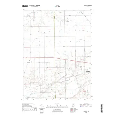
2019 Map of Richvalley
USGS Topo · Published 2019About this map
Richvalley and the Wabash River corridor anchor this portion of northern Indiana, where the drainage of the Wabash and Eel River systems defines the agricultural landscape. The map illustrates a complex network of man-made waterways including Busick Ditch, Johnson Ditch, and Beamer Ditch, which work to manage the low-lying terrain between the rivers. For genealogists and local historians, several small burial grounds are documented across the landscape, such as Richvalley Cem, Wallace Cem, and the Huff Cem to the north. A significant cultural landmark, the Francis Godfroy Cem, is located near the western boundary. The settlement of Erie sits along the northern rail line, while the historical influence of the river is seen in the winding courses of Daniel Cr and Kentner Cr as they feed into the larger Wabash valley.
Find a feature on this map
73 named features on this map. Tap any name to fly to it.
Don’t see what you’re looking for? This feature index may not catch every label — zoom into the map to look around manually.
Map Details
Editions of this 2019 Richvalley Map
This is the sole edition of this map. No revisions or reprints were ever made.
Other maps of this area

1951 · Peru
USGS Topo · 1:24,000

1951 · Bunker Hill
USGS Topo · 1:24,000

1951 · Richvalley
USGS Topo · 1:24,000

1952 · Wabash
USGS Topo · 1:24,000

1953 · Somerset
USGS Topo · 1:24,000

1953 · Peoria
USGS Topo · 1:24,000

1953 · Danville
USGS Topo · 1:250,000

1953 · Muncie
USGS Topo · 1:250,000

1955 · Danville
USGS Topo · 1:250,000

1956 · Muncie
USGS Topo · 1:250,000