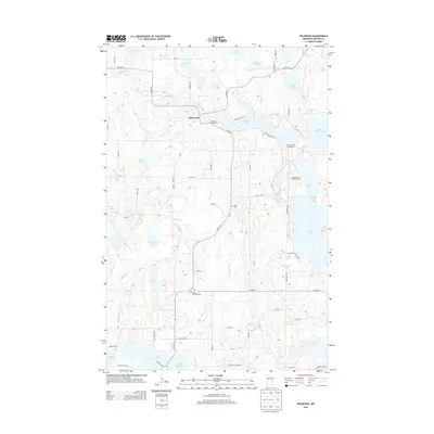
2013 Map of Richwood
USGS Topo · Published 2013About this map
Richwood serves as the central hub of this Becker County landscape, where the Buffalo River and Pelican River systems carve through a region defined by its dense glacial lakes. The map documents a transition from the agricultural lands along Co HWY-14 and Co HWY-21 to the clustered lakefront developments surrounding Buffalo Lake and Floyd Lake. Genealogists will find significant value in the placement of several rural burial grounds, including Bakke Lutheran Cem near the Pelican River and the Holmesville Township Cem to the east.
Find a feature on this map
37 named features on this map. Tap any name to fly to it.
Don’t see what you’re looking for? This feature index may not catch every label — zoom into the map to look around manually.
Map Details
Editions of this 2013 Richwood Map
This is the sole edition of this map. No revisions or reprints were ever made.
Other maps of this area

1953 · Brainerd
USGS Topo · 1:250,000

1954 · Bemidji
USGS Topo · 1:250,000

1957 · Brainerd
USGS Topo · 1:250,000

1957 · Bemidji
USGS Topo · 1:250,000

1958 · Bemidji
USGS Topo · 1:250,000

1958 · Brainerd
USGS Topo · 1:250,000

1959 · Flat Lake
USGS Topo · 1:24,000

1959 · Rochert
USGS Topo · 1:24,000

1959 · Richwood
USGS Topo · 1:24,000
1959 · Callaway
USGS Topo · 1:24,000