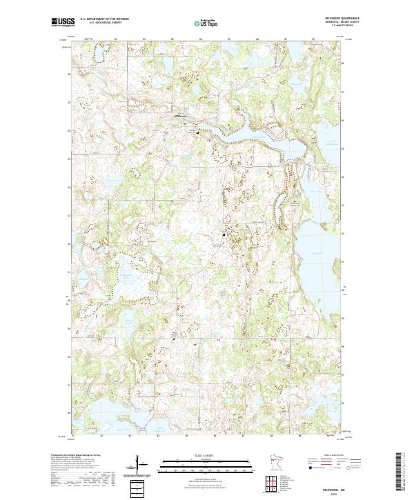
2022 Map of Richwood
USGS Topo · Published 2022About this map
Richwood is a focal point of this Becker County landscape, where the Buffalo River winds through a terrain defined by an intricate network of glacial lakes and wetlands. The settlement pattern is deeply connected to these water bodies, with seasonal and permanent residences clustered around Buffalo Lake and the shorelines of Rice Lake and Little Round Lake. This map captures the region's rural character and long-standing community roots, evidenced by the numerous burial grounds scattered across the township lines. Genealogists and local historians can find the Holmesville Township Cem, the Lund Cem, and the Bakke Lutheran Cem near the banks of the Pelican River. The southern portion of the sheet transitions toward the Tamarac Lake and Little Floyd Lake areas, showing a landscape where modern roads like Co Rd 21 follow the historic paths between these significant water resources.
Find a feature on this map
79 named features on this map. Tap any name to fly to it.
Don’t see what you’re looking for? This feature index may not catch every label — zoom into the map to look around manually.
Map Details
Editions of this 2022 Richwood Map
This is the sole edition of this map. No revisions or reprints were ever made.
Other maps of this area

1953 · Brainerd
USGS Topo · 1:250,000

1954 · Bemidji
USGS Topo · 1:250,000

1957 · Brainerd
USGS Topo · 1:250,000

1957 · Bemidji
USGS Topo · 1:250,000

1958 · Bemidji
USGS Topo · 1:250,000

1958 · Brainerd
USGS Topo · 1:250,000

1959 · Flat Lake
USGS Topo · 1:24,000

1959 · Rochert
USGS Topo · 1:24,000

1959 · Richwood
USGS Topo · 1:24,000
1959 · Callaway
USGS Topo · 1:24,000