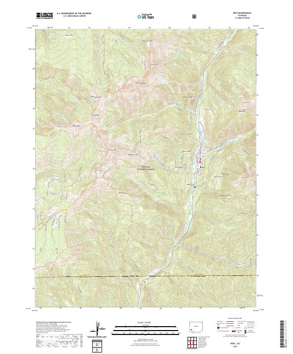
2022 Map of Rico
USGS Topo · Published 2022About this map
The town of Rico serves as the focal point for this survey of the High San Juans, situated along the upper reaches of the Dolores River. Located within the San Juan National Forest, the settlement is surrounded by a high-altitude landscape of significant peaks including Sockrider Peak, Calico Peak, and Papoose Peak. The area's mining history is physically marked by the Aztec Mine and remnants of early transportation routes like the Rgs Winter Trl, while local genealogy is rooted at the Rico Cem just south of the main townsite.
Find a feature on this map
80 named features on this map. Tap any name to fly to it.
Don’t see what you’re looking for? This feature index may not catch every label — zoom into the map to look around manually.
Map Details
Editions of this 2022 Rico Map
This is the sole edition of this map. No revisions or reprints were ever made.
Other maps of this area

1897 · Rico
USGS Topo · 1:62,500

1897 · Telluride
USGS Topo · 1:62,500

1898 · Engineer Mountain
USGS Topo · 1:62,500

1898 · Rico
USGS Topo · 1:62,500

1899 · Rico
USGS Topo · 1:62,500

1900 · Engineer Mountain
USGS Topo · 1:62,500

1904 · Telluride
USGS Topo · 1:62,500

1908 · Engineer Mountain
USGS Topo · 1:62,500

1945 · Durango
USGS Topo · 1:250,000

1953 · Mount Wilson
USGS Topo · 1:24,000