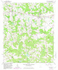
1964 Map of Ridge Spring
USGS Topo · Published 1983About this map
Ridge Spring serves as a significant rail and transit hub in the mid-1960s, situated where the Southern railroad line meets historical thoroughfares. The landscape is defined by its transition from the agricultural uplands near Ward to the riparian network feeding the South Fork Edisto River. This era of South Carolina history is marked by the presence of legacy infrastructure, such as the Old Plank Road and an Old Railroad Grade, which reveal earlier patterns of commerce and movement across the Saluda and Edgefield county lines. Numerous rural institutions, including Spann Ch and Ridge Hill High Sch, are shown alongside family-named landmarks like Yonce Millpond and Watson Cem. The terrain is characterized by a complex series of drainage branches like Clouds Creek and Lotts Creek, illustrating the environmental factors that shaped the placement of local settlements and industries.
Find a feature on this map
45 named features on this map. Tap any name to fly to it.
Don’t see what you’re looking for? This feature index may not catch every label — zoom into the map to look around manually.
Map Details
Editions of this 1964 Ridge Spring Map
2 editions found
Other maps of this area

1920 · Aiken
USGS Topo · 1:48,000

1921 · Aiken
USGS Topo · 1:62,500

1923 · Warrenville
USGS Topo · 1:48,000

1928 · Warrenville
USGS Topo · 1:62,500

1943 · Aiken
USGS Topo · 1:62,500

1943 · Warrenville
USGS Topo · 1:62,500

1954 · Augusta
USGS Topo · 1:250,000

1957 · Augusta
USGS Topo · 1:250,000

1958 · Augusta
USGS Topo · 1:250,000

1961 · Augusta
USGS Topo · 1:250,000