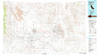
1993 Map of Ridgecrest
USGS Topo · Published 1993About this map
The China Lake Naval Weapons Center dominates this high-desert landscape, illustrating the mid-century intersection of expansive military test ranges and the region's industrial mineral heritage. Centered on the sprawling playa of China Lake, the map traces the logistical networks connecting the namesake settlement of Ridgecrest with the outlying areas of Inyokern and Brown. To the east, the industrial character of the Mojave is evident at Searles Lake, where the Trona Railway serves the mineral-rich basins of Trona, Argus, and Westend.
Find a feature on this map
128 named features on this map. Tap any name to fly to it.
Don’t see what you’re looking for? This feature index may not catch every label — zoom into the map to look around manually.
Map Details
Editions of this 1993 Ridgecrest Map
2 editions found
Other maps of this area

1903 · Randsburg
USGS Topo · 1:62,500

1905 · Olancha
USGS Topo · 1:125,000

1906 · Kernville
USGS Topo · 1:125,000

1907 · Olancha
USGS Topo · 1:125,000

1908 · Furnace Creek
USGS Topo · 1:250,000

1908 · Kernville
USGS Topo · 1:125,000

1908 · Ballarat
USGS Topo · 1:250,000

1910 · Furnace Creek
USGS Topo · 1:250,000

1911 · Randsburg
USGS Topo · 1:62,500

1912 · Randsburg
USGS Topo · 1:62,500