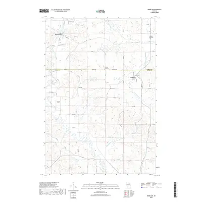
2018 Map of Ridgeland
USGS Topo · Published 2018About this map
Prairie Farm and Ridgeland anchor this northern Wisconsin landscape, where the border between Barron and Dunn counties divides a region of winding creek valleys and rural homesteads. The Hay River and its tributaries, including Turtle Cr and Washburn Farm Cr, carve through the terrain, creating a complex drainage pattern that has long influenced the placement of roads and farms. Numerous small burial grounds, such as Evergreen Cem and Oak Grove Cem, are scattered across the quadrangle, serving as vital landmarks for genealogists and local historians. The presence of Cub Acres Airport south of Vanceburg Cem highlights the continued integration of modern utility into this traditional agricultural setting. The map detail preserves the exact grid of local routes like Co Hwy F and Co Rd V as they connect these small communities.
Find a feature on this map
68 named features on this map. Tap any name to fly to it.
Don’t see what you’re looking for? This feature index may not catch every label — zoom into the map to look around manually.
Map Details
Editions of this 2018 Ridgeland Map
This is the sole edition of this map. No revisions or reprints were ever made.
Other maps of this area

1948 · Downing
USGS Topo · 1:62,500

1949 · Ridgeland
USGS Topo · 1:62,500

1950 · Downing
USGS Topo · 1:62,500

1950 · Turtle Lake
USGS Topo · 1:62,500

1951 · Ridgeland
USGS Topo · 1:62,500

1951 · Barron
USGS Topo · 1:62,500

1952 · Turtle Lake
USGS Topo · 1:62,500

1953 · Rice Lake
USGS Topo · 1:250,000

1953 · Stillwater
USGS Topo · 1:250,000

1955 · Stillwater
USGS Topo · 1:250,000