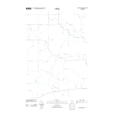
2013 Map of Ridgeland NE
USGS Topo · Published 2013About this map
The agrarian landscape of Sand Creek, Wisconsin, is defined by its intricate drainage networks and a precise grid of county roads. Flowing through the heart of the territory, the Lower Pine Cr and its tributary, the S Fork Lower Pine Cr, trace winding paths that contrast with the rigid lines of Co Hwy-V and Co Hwy-U. The map reveals the meticulous subdivision of the countryside, where named thoroughfares like Pine Creek Rd and numbered avenues serve a patchwork of rural holdings. In the southern reaches, the corridor along State Road 64 marks a primary artery connecting the region, while the headwaters of Hay Cr and Otter Cr indicate the watershed's transition into the surrounding hills. This survey documents the persistent rural character of Dunn County, highlighting how local topography still guides the placement of local infrastructure and land use.
Find a feature on this map
55 named features on this map. Tap any name to fly to it.
Don’t see what you’re looking for? This feature index may not catch every label — zoom into the map to look around manually.
Map Details
Editions of this 2013 Ridgeland NE Map
This is the sole edition of this map. No revisions or reprints were ever made.
Other maps of this area

1949 · New Auburn
USGS Topo · 1:62,500

1949 · Ridgeland
USGS Topo · 1:62,500

1951 · Ridgeland
USGS Topo · 1:62,500

1951 · New Auburn
USGS Topo · 1:62,500

1951 · Chetek
USGS Topo · 1:62,500

1951 · Barron
USGS Topo · 1:62,500

1953 · Rice Lake
USGS Topo · 1:250,000

1959 · Rice Lake
USGS Topo · 1:250,000
1975 · Colfax North
USGS Topo · 1:24,000
1975 · Sand Creek
USGS Topo · 1:24,000