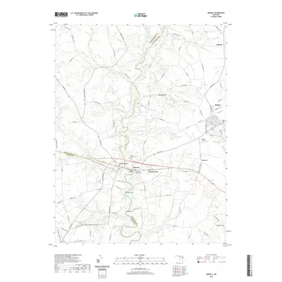
2019 Map of Ridgely
USGS Topo · Published 2019About this map
Tuckahoe Cr carves a winding boundary between Queen Anne’s, Talbot, and Caroline Counties, anchoring a landscape where agricultural history and small crossroads settlements remain clearly defined. The village of Ridgely serves as a local hub, mirrored by smaller communities such as Oakland, Jumptown, and Thomas Town that dot the surrounding countryside. This 2019 survey captures the geographic legacy of the Eastern Shore, from the tidal reaches near Stony Point to the historical resting places at Green Mount Cem and Saint Pauls Episcopal Cem. A network of rural roads like Ninetown Rd and Seward Rd connects these points, tracing old property lines and natural drainages. Modern infrastructure like the Carmean Airport and the Tuckahoe Bridge sit alongside numerous named branches, including School House Br and Meeting House Br, which hint at the vanished community centers of previous centuries.
Find a feature on this map
95 named features on this map. Tap any name to fly to it.
Don’t see what you’re looking for? This feature index may not catch every label — zoom into the map to look around manually.
Map Details
Editions of this 2019 Ridgely Map
This is the sole edition of this map. No revisions or reprints were ever made.
Other maps of this area

1898 · Choptank
USGS Topo · 1:125,000

1898 · Tolchester
USGS Topo · 1:125,000

1899 · Dover
USGS Topo · 1:125,000

1901 · Chestertown
USGS Topo · 1:62,500

1903 · Tolchester
USGS Topo · 1:125,000

1904 · St. Michaels
USGS Topo · 1:62,500

1905 · Denton
USGS Topo · 1:62,500

1905 · Barclay
USGS Topo · 1:62,500

1906 · Dover
USGS Topo · 1:125,000

1908 · Tolchester
USGS Topo · 1:125,000