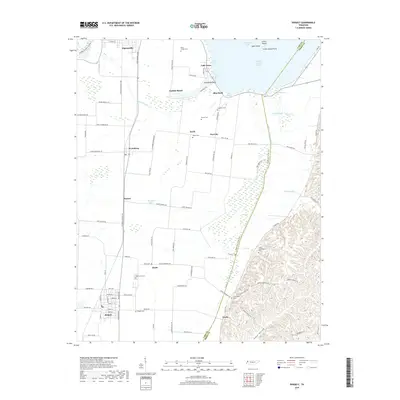
2019 Map of Ridgely
USGS Topo · Published 2019About this map
Running Reelfoot Bayou and the intricate wetlands of Lake Isom National Wildlife Refuge dominate this landscape on the border of Lake and Obion counties. The map details a unique amphibious environment where land and water merge, featuring distinct aquatic landmarks like Glory Hole, Magic Hole, and Lids Pocket. Cultural history is preserved through a dense concentration of burial grounds, from Davis Chapel Cem in the north to Long Cunningham Cem further south, suggesting a long-standing rural community structure. Small residential clusters such as Sunkist Beach and Blue Bank line the shore, while the town of Ridgely serves as a southern hub. The presence of the Eagle Nest Levee Trail and Tiptonville Obion Levee Rd highlights the local reliance on water management and levee systems to navigate and inhabit this portion of the Reelfoot Lake region.
Find a feature on this map
108 named features on this map. Tap any name to fly to it.
Don’t see what you’re looking for? This feature index may not catch every label — zoom into the map to look around manually.
Map Details
Editions of this 2019 Ridgely Map
This is the sole edition of this map. No revisions or reprints were ever made.
Other maps of this area

1925 · Reelfoot Lake
USGS Topo · 1:62,500

1939 · Reelfoot Lake
USGS Topo · 1:62,500

1939 · Portageville
USGS Topo · 1:62,500

1939 · Dyersburg
USGS Topo · 1:62,500

1939 · Caruthersville
USGS Topo · 1:62,500

1951 · Caruthersville
USGS Topo · 1:62,500

1952 · Lane
USGS Topo · 1:24,000

1952 · Miston
USGS Topo · 1:24,000

1955 · Portageville
USGS Topo · 1:62,500

1956 · Reelfoot Lake
USGS Topo · 1:62,500