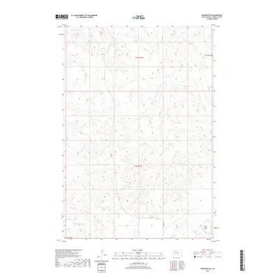
2017 Map of Ridgeview NE
USGS Topo · Published 2017About this map
The northern plains of District 6 in Dewey County are defined by a network of drainage basins and rural infrastructure. The landscape is carved by the winding courses of Swan Cr, Bull Cr, and Cottonwood Cr, which serve as the primary topographical markers in this section of South Dakota. Human impact on the land is represented by specialized facilities like the Booth Ranch Airport in the southeastern corner, and a series of numbered transit corridors including Blvd R R 3 and Railroad 3. This survey highlights the sparse, ranch-oriented settlement pattern of the early 21st century, where large tracts of land are organized by the Public Land Survey System as indicated by township and range markers such as t15n r27e and t14n r27e.
Find a feature on this map
10 named features on this map. Tap any name to fly to it.
Don’t see what you’re looking for? This feature index may not catch every label — zoom into the map to look around manually.
Map Details
Editions of this 2017 Ridgeview NE Map
This is the sole edition of this map. No revisions or reprints were ever made.
Other maps of this area

1951 · Ridgeview NW
USGS Topo · 1:24,000

1951 · Ridgeview NE
USGS Topo · 1:24,000

1951 · La Plant
USGS Topo · 1:24,000

1952 · Whitehorse
USGS Topo · 1:24,000

1952 · Trail City SW
USGS Topo · 1:24,000

1952 · Glencross SE
USGS Topo · 1:24,000

1953 · McIntosh
USGS Topo · 1:250,000

1958 · McIntosh
USGS Topo · 1:250,000
1981 · La Plant SW
USGS Topo · 1:24,000
1981 · Ridgeview
USGS Topo · 1:24,000