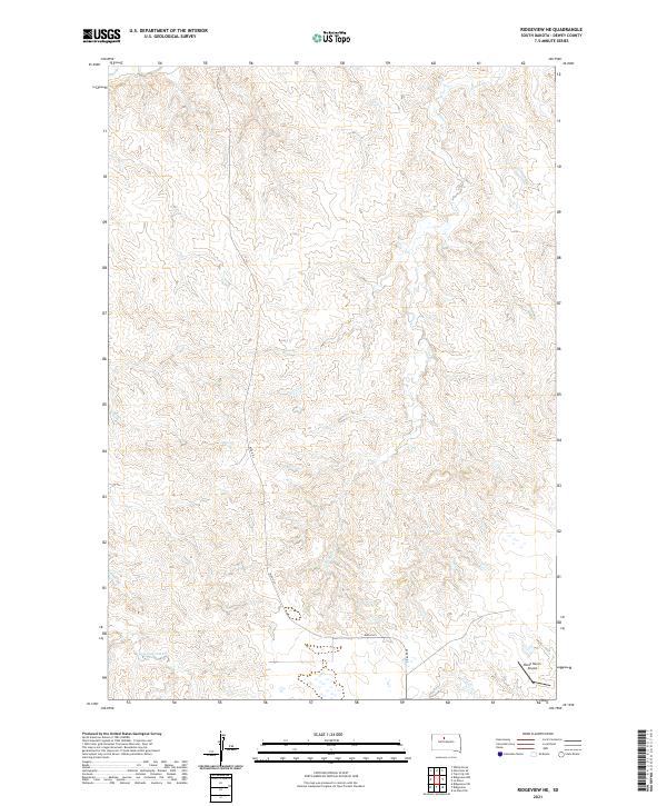
2021 Map of Ridgeview NE
USGS Topo · Published 2021About this map
Swan Cr and Bull Cr carve through the dissected plateau of Dewey County, defining the drainage patterns of this rural South Dakota landscape. The terrain is characterized by intricate contouring that reveals the erosion of the high plains, where watercourses like Cottonwood Cr wind through the township grids. Human activity is concentrated along established corridors, notably at the Booth Ranch Airport in the southeastern corner of the quadrangle. This small airfield sits near the intersection of several local transportation routes, including Blvd R R 3 and Railroad 3. The map detail highlights the persistent intersection of ranching life and aviation in a region where vast distances necessitate specialized infrastructure for travel and land management.
Find a feature on this map
9 named features on this map. Tap any name to fly to it.
Don’t see what you’re looking for? This feature index may not catch every label — zoom into the map to look around manually.
Map Details
Editions of this 2021 Ridgeview NE Map
This is the sole edition of this map. No revisions or reprints were ever made.
Other maps of this area

1951 · Ridgeview NW
USGS Topo · 1:24,000

1951 · Ridgeview NE
USGS Topo · 1:24,000

1951 · La Plant
USGS Topo · 1:24,000

1952 · Whitehorse
USGS Topo · 1:24,000

1952 · Trail City SW
USGS Topo · 1:24,000

1952 · Glencross SE
USGS Topo · 1:24,000

1953 · McIntosh
USGS Topo · 1:250,000

1958 · McIntosh
USGS Topo · 1:250,000
1981 · La Plant SW
USGS Topo · 1:24,000
1981 · Ridgeview
USGS Topo · 1:24,000