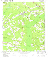
1979 Map of Ridgeville
USGS Topo · Published 1980About this map
Ridgeville and the Lowcountry landscape of the late 1970s are defined by a network of rural churches and sprawling wetlands. The town itself serves as a central hub near the intersection of the Southern railroad and state highways, supported by local institutions like the Clay Hill Sch. To the south, Givhans Ferry State Park sits along the banks of the Edisto River, while the eastern portion of the map is dominated by the dense, marshy expanses of Cypress Swamp. The area's social fabric is visible through numerous congregation sites, including New Jerusalem Ch, St Johns Ch, and the Cypress Campground. Local recreation and industry are represented by the Summerville Speedway and a Claypit near Rumphs Hill, illustrating a mix of traditional agriculture, small-town life, and the natural geography of the Berkeley and Dorchester county line.
Find a feature on this map
42 named features on this map. Tap any name to fly to it.
Don’t see what you’re looking for? This feature index may not catch every label — zoom into the map to look around manually.
Map Details
Editions of this 1979 Ridgeville Map
2 editions found
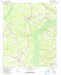
Other maps of this area

1918 · Cottageville
USGS Topo · 1:62,500

1919 · Summerville
USGS Topo · 1:48,000

1919 · Ridgeville
USGS Topo · 1:48,000

1920 · Ravenels
USGS Topo · 1:62,500

1920 · Ridgeville
USGS Topo · 1:62,500

1920 · Summerville
USGS Topo · 1:62,500

1943 · Cottageville
USGS Topo · 1:62,500

1943 · Ridgeville
USGS Topo · 1:62,500

1944 · Ravenels
USGS Topo · 1:62,500

1944 · Summerville
USGS Topo · 1:62,500