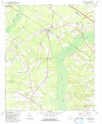
1979 Map of Ridgeville
USGS Topo · Published 1980About this map
Givhans Ferry State Park anchors the southwestern corner of this Dorchester County landscape, situated where the terrain transitions toward the dense networks of Cypress Swamp. The town of Ridgeville serves as a central hub, defined by the intersection of the Southern railroad and local roads that connect scattered rural congregations and historic school sites. This late 1970s record detail a transition between protected riverfront lands and the low-lying wetlands of Four Hole Swamp and Cat Bay.
Find a feature on this map
41 named features on this map. Tap any name to fly to it.
Don’t see what you’re looking for? This feature index may not catch every label — zoom into the map to look around manually.
Map Details
Editions of this 1979 Ridgeville Map
2 editions found
Other maps of this area

1918 · Cottageville
USGS Topo · 1:62,500

1919 · Summerville
USGS Topo · 1:48,000

1919 · Ridgeville
USGS Topo · 1:48,000

1920 · Ravenels
USGS Topo · 1:62,500

1920 · Ridgeville
USGS Topo · 1:62,500

1920 · Summerville
USGS Topo · 1:62,500

1943 · Cottageville
USGS Topo · 1:62,500

1943 · Ridgeville
USGS Topo · 1:62,500

1944 · Ravenels
USGS Topo · 1:62,500

1944 · Summerville
USGS Topo · 1:62,500