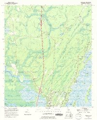
1993 Map of Ridgeville
USGS Topo · Published 1995About this map
Buffalo Swamp and the labyrinthine waterways of the Altama River delta define this coastal Georgia landscape in the early 1990s. The northern edge of Darien and the historic settlement of Ashantilly anchor the southern portion of the sheet, where the land transitions from solid ground to the intricate marshes of Potosi Island and Kidd Island. This map is particularly dense with genealogical markers, documenting numerous small family and community burial grounds such as Ebenezer Cem, Ardoch Cem, and the Cuthbert and Grant Cem.
Find a feature on this map
67 named features on this map. Tap any name to fly to it.
Don’t see what you’re looking for? This feature index may not catch every label — zoom into the map to look around manually.
Map Details
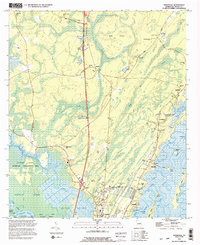
Editions of this 1993 Ridgeville Map
2 editions found
Other maps of this area

1918 · Everett City
USGS Topo · 1:62,500

1920 · Sapelo River
USGS Topo · 1:62,500

1920 · Everett City
USGS Topo · 1:62,500

1921 · Darien
USGS Topo · 1:62,500

1943 · Ludowici
USGS Topo · 1:62,500

1943 · Sapelo River
USGS Topo · 1:62,500

1944 · Everett City
USGS Topo · 1:62,500

1945 · Sapelo River
USGS Topo · 1:62,500

1946 · Brunswick
USGS Topo · 1:250,000

1948 · Brunswick
USGS Topo · 1:250,000