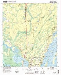
1993 Map of Ridgeville
USGS Topo · Published 1995About this map
Buffalo Swamp dominates the southwestern quadrant of this coastal McIntosh County landscape, where the Altamaha River feeds into a complex network of waterways including Cathead Creek and Hall Creek. The 1993 revision reveals a region defined by its tidal marshes and islands, such as Kidd Island and Potosi Island, alongside small established communities like Ardoch and Meridian. This period shows the rural infrastructure of coastal Georgia, with numerous family and community burial grounds like Robson Cem, Hutchison Cem, and Ceyon Cem scattered along the higher ground.
Find a feature on this map
60 named features on this map. Tap any name to fly to it.
Don’t see what you’re looking for? This feature index may not catch every label — zoom into the map to look around manually.
Map Details
Editions of this 1993 Ridgeville Map
2 editions found
Other maps of this area

1918 · Everett City
USGS Topo · 1:62,500

1920 · Sapelo River
USGS Topo · 1:62,500

1920 · Everett City
USGS Topo · 1:62,500

1921 · Darien
USGS Topo · 1:62,500

1943 · Ludowici
USGS Topo · 1:62,500

1943 · Sapelo River
USGS Topo · 1:62,500

1944 · Everett City
USGS Topo · 1:62,500

1945 · Sapelo River
USGS Topo · 1:62,500

1946 · Brunswick
USGS Topo · 1:250,000

1948 · Brunswick
USGS Topo · 1:250,000