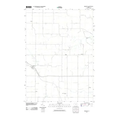
2010 Map of Ridgeway
USGS Topo · Published 2010About this map
Ridgeway stands as the primary hub of this northern Iowa landscape, anchored by the Ridgeway Post Office along the rail corridor. The map reveals a deeply rooted rural community in Winneshiek County, evidenced by a high density of burial grounds that mark the heritage of early settlers. Notable sites include the Orleans Cemetery, Lincoln Cemetery, and the Madison Settlement Cemetery, each reflecting the organized townships and family lineages that defined the area.
Find a feature on this map
36 named features on this map. Tap any name to fly to it.
Don’t see what you’re looking for? This feature index may not catch every label — zoom into the map to look around manually.
Map Details
Editions of this 2010 Ridgeway Map
This is the sole edition of this map. No revisions or reprints were ever made.
Other maps of this area

1906 · Decorah
USGS Topo · 1:125,000

1954 · Mason City
USGS Topo · 1:250,000

1957 · Mason City
USGS Topo · 1:250,000

1958 · Mason City
USGS Topo · 1:250,000

1958 · La Crosse
USGS Topo · 1:250,000

1961 · La Crosse
USGS Topo · 1:250,000

1965 · La Crosse
USGS Topo · 1:250,000

1975 · Decorah 2 NW
USGS Topo · 1:24,000

1975 · Decorah 3 NW
USGS Topo · 1:24,000
1975 · Decorah 2 NE
USGS Topo · 1:24,000