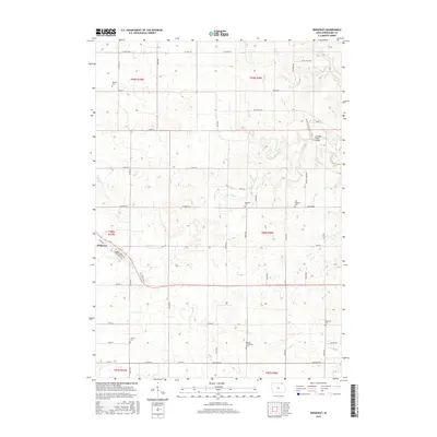
2015 Map of Ridgeway
USGS Topo · Published 2015About this map
The town of Ridgeway serves as the primary hub in this portion of Winneshiek County, situated along the Soo Line Railroad St and Co Hwy A46. The surrounding landscape is defined by a dense network of country roads and creek drainage systems, including Walnut Cr and Ten Mile Cr. This 2015 survey reveals a significant concentration of burial sites throughout the rural townships, suggesting the deep roots of established farming communities. Genealogists can identify the locations of Orleans Cem, Madison Cem, East Madison Cem, and the Madison Settlement Cem. Smaller tributaries like Burr Oak Cr and Dry Run carve through the agricultural blocks, while infrastructure landmarks such as the Ten Mile Creek Bridge mark important crossing points in this northern Iowa countryside.
Find a feature on this map
54 named features on this map. Tap any name to fly to it.
Don’t see what you’re looking for? This feature index may not catch every label — zoom into the map to look around manually.
Map Details
Editions of this 2015 Ridgeway Map
This is the sole edition of this map. No revisions or reprints were ever made.
Other maps of this area

1906 · Decorah
USGS Topo · 1:125,000

1954 · Mason City
USGS Topo · 1:250,000

1957 · Mason City
USGS Topo · 1:250,000

1958 · Mason City
USGS Topo · 1:250,000

1958 · La Crosse
USGS Topo · 1:250,000

1961 · La Crosse
USGS Topo · 1:250,000

1965 · La Crosse
USGS Topo · 1:250,000

1975 · Decorah 2 NW
USGS Topo · 1:24,000

1975 · Decorah 3 NW
USGS Topo · 1:24,000
1975 · Decorah 2 NE
USGS Topo · 1:24,000