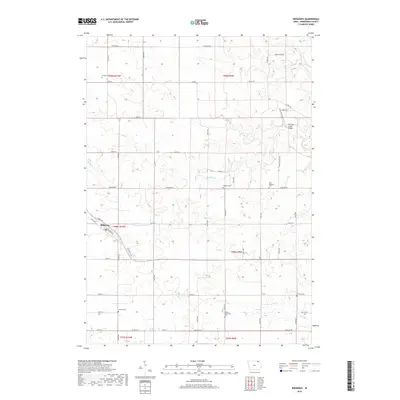
2018 Map of Ridgeway
USGS Topo · Published 2018About this map
Ridgeway serves as the primary hub in this portion of Winneshiek County, situated where Railroad St and 307th Ave meet. The landscape is defined by a dense network of country roads and local drainage systems, including Walnut Cr and Ten Mile Cr, the latter featuring the notable Ten Mile Creek Bridge. This 2018 survey reveals a terrain deeply connected to its early settlement history, evidenced by a high concentration of rural burial sites distributed across the townships. Genealogists and local researchers will find interest in the scattered locations of the Madison Settlement Cem, Lincoln Cem, and the Orleans Cem in the north. The proximity of the East Madison Cem and Madison Cem suggests a long-standing community structure centered around these small rural intersections and creek beds like Burr Oak Cr.
Find a feature on this map
38 named features on this map. Tap any name to fly to it.
Don’t see what you’re looking for? This feature index may not catch every label — zoom into the map to look around manually.
Map Details
Editions of this 2018 Ridgeway Map
This is the sole edition of this map. No revisions or reprints were ever made.
Other maps of this area

1906 · Decorah
USGS Topo · 1:125,000

1954 · Mason City
USGS Topo · 1:250,000

1957 · Mason City
USGS Topo · 1:250,000

1958 · Mason City
USGS Topo · 1:250,000

1958 · La Crosse
USGS Topo · 1:250,000

1961 · La Crosse
USGS Topo · 1:250,000

1965 · La Crosse
USGS Topo · 1:250,000

1975 · Decorah 2 NW
USGS Topo · 1:24,000

1975 · Decorah 3 NW
USGS Topo · 1:24,000
1975 · Decorah 2 NE
USGS Topo · 1:24,000