2015 Map of Ridgway
USGS Topo · Published 2015About this map
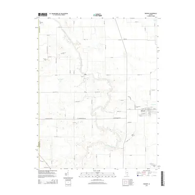
The North Fork Saline River snakes through this Gallatin County landscape, its meandering oxbows and floodplains defining the local geography between Elba and Ridgway. This 2015 survey reveals a terrain deeply connected to its rural heritage, where family-named landmarks and country crossroads persist. The density of burial sites across the quadrangle, from the Oak Grove Church Cem in the west to the New Bradley Family Cem in the southeast, provides a valuable spatial record for genealogical research in this part of Illinois. Significant tributaries such as Cane Cr and White Oak Cr carve through the agricultural tracts, while the village of Ridgway shows a structured grid of streets including W Main St and S Karber St. The map illustrates a community where the land’s natural drainage patterns and established road networks like Eldorado Blacktop Rd have dictated the pace of development.
Find a feature on this map
75 named features on this map. Tap any name to fly to it.
Don’t see what you’re looking for? This feature index may not catch every label — zoom into the map to look around manually.
Map Details
Editions of this 2015 Ridgway Map
This is the sole edition of this map. No revisions or reprints were ever made.
Other maps of this area

1905 · Eldorado
USGS Topo · 1:62,500

1905 · New Haven
USGS Topo · 1:62,500

1906 · New Haven
USGS Topo · 1:62,500

1906 · Eldorado
USGS Topo · 1:62,500

1916 · Shawneetown
USGS Topo · 1:62,500

1916 · Equality
USGS Topo · 1:62,500

1949 · Paducah
USGS Topo · 1:250,000

1949 · New Haven
USGS Topo · 1:62,500

1950 · Paducah
USGS Topo · 1:250,000

1954 · Paducah
USGS Topo · 1:250,000