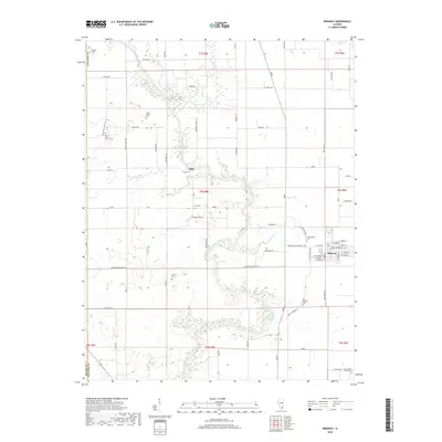
2018 Map of Ridgway
USGS Topo · Published 2018About this map
The North Fork Saline River snakes through the center of this Gallatin County landscape, its meandering oxbows and wetlands defining the geography south of Elba. In the eastern portion of the sheet, the village of Ridgway serves as a local hub, oriented around a grid of streets including W Main St and S Joseph Dr. The rural surroundings are marked by a dense network of country roads named for local families and landmarks, such as Barefoot Jones Ln, Stahlies Ln, and Overton Rd.
Find a feature on this map
87 named features on this map. Tap any name to fly to it.
Don’t see what you’re looking for? This feature index may not catch every label — zoom into the map to look around manually.
Map Details
Editions of this 2018 Ridgway Map
This is the sole edition of this map. No revisions or reprints were ever made.
Other maps of this area

1905 · Eldorado
USGS Topo · 1:62,500

1905 · New Haven
USGS Topo · 1:62,500

1906 · New Haven
USGS Topo · 1:62,500

1906 · Eldorado
USGS Topo · 1:62,500

1916 · Shawneetown
USGS Topo · 1:62,500

1916 · Equality
USGS Topo · 1:62,500

1949 · Paducah
USGS Topo · 1:250,000

1949 · New Haven
USGS Topo · 1:62,500

1950 · Paducah
USGS Topo · 1:250,000

1954 · Paducah
USGS Topo · 1:250,000