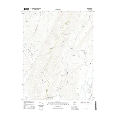
2014 Map of Rig
USGS Topo · Published 2014About this map
Patterson Creek Mtn and Charles Knob anchor the high terrain along the border of Grant and Hardy Counties, defining a landscape shaped by the deep cuts of the South Branch Potomac River. In the southern portion of the sheet, the river winds through the Petersburg Gap, a prominent break in the ridgeline where the Petersburg Gap Bridge facilitates passage. Small settlements such as Rig, Kessel, and Arthur are linked by a network of winding roads like Snyderville Rd and Rig Rd, following the natural drainage of Hutton Run and Patterson Cr. The distribution of springs, including Ebb Spring and Burnt House Spring, suggests a reliance on local water sources for the isolated farmsteads and rural communities throughout these valleys. Historically significant crossings like Badleys Ford on Lunice Creek further illustrate the traditional transit routes used before modern infrastructure.
Find a feature on this map
84 named features on this map. Tap any name to fly to it.
Don’t see what you’re looking for? This feature index may not catch every label — zoom into the map to look around manually.
Map Details
Editions of this 2014 Rig Map
This is the sole edition of this map. No revisions or reprints were ever made.
Other maps of this area

1891 · Romney
USGS Topo · 1:125,000

1892 · Franklin
USGS Topo · 1:125,000

1892 · Woodstock
USGS Topo · 1:125,000

1895 · Piedmont
USGS Topo · 1:125,000

1896 · Franklin
USGS Topo · 1:125,000

1920 · Petersburg
USGS Topo · 1:48,000

1920 · Moorefield
USGS Topo · 1:62,500

1921 · Orkney Springs
USGS Topo · 1:48,000

1921 · Petersburg
USGS Topo · 1:48,000

1921 · Greenland Gap
USGS Topo · 1:62,500