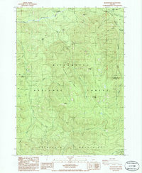
1986 Map of Rigdon Point
USGS Topo · Published 1986About this map
Willamette National Forest dominates this mid-1980s terrain, where the headwaters of the Middle Fork Willamette River carve through high country near the Lane and Douglas County line. The map highlights a network of drainage systems including Staley Creek and Tumblebug Creek, which define the rugged geography leading toward the crest of the Calapooya Mountains. Land management and resource extraction are evident through numerous scattered Quarry sites and a Borrow Pit located near the river.
Find a feature on this map
30 named features on this map. Tap any name to fly to it.
Don’t see what you’re looking for? This feature index may not catch every label — zoom into the map to look around manually.
Map Details
Editions of this 1986 Rigdon Point Map
This is the sole edition of this map. No revisions or reprints were ever made.
Other maps of this area

1917 · Diamond Lake
USGS Topo · 1:125,000

1925 · Waldo Lake
USGS Topo · 1:125,000

1956 · Toketee Falls
USGS Topo · 1:62,500

1956 · Waldo Lake
USGS Topo · 1:62,500

1956 · Summit Lake
USGS Topo · 1:62,500

1956 · Oakridge
USGS Topo · 1:62,500

1958 · Roseburg
USGS Topo · 1:250,000

1959 · Roseburg
USGS Topo · 1:250,000

1978 · Diamond Lake
USGS Topo · 1:100,000

1983 · Oakridge
USGS Topo · 1:100,000