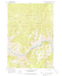
1964 Map of Riggins Hot Springs
USGS Topo · Published 1978About this map
The Salmon River carves through the heart of the Nez Perce National Forest, creating a dramatic landscape of steep ridges and deep canyons. Along the river's path, Riggins Hot Springs stands as a focal point, situated near Ruby Rapids and the Allison Creek Campground. The map reveals the early recreational and utility infrastructure of the mid-1960s, including a Lookout Tower on Chair Point and several remote habitations such as Hinkley Cabin and Long Cabin. Notable terrain features like Keating Ridge and Van Ridge flank the river valley, while small-scale mining activity is indicated by a Prospect located high on the slopes above Allison Creek. This survey captures a moment when the area was primarily accessed by Jeep Trails, emphasizing the isolated character of the Idaho wilderness before modern development reached these reaches of the Salmon River.
Find a feature on this map
32 named features on this map. Tap any name to fly to it.
Don’t see what you’re looking for? This feature index may not catch every label — zoom into the map to look around manually.
Map Details
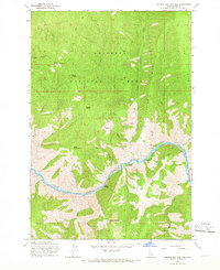
Editions of this 1964 Riggins Hot Springs Map
2 editions found
Other maps of this area

1938 · Riggins
USGS Topo · 1:96,000

1945 · Riggins
USGS Topo · 1:125,000

1955 · Grangeville
USGS Topo · 1:250,000

1959 · Grangeville
USGS Topo · 1:250,000

1963 · John Day Mtn
USGS Topo · 1:24,000

1963 · Lucile
USGS Topo · 1:24,000

1963 · Hershey Point
USGS Topo · 1:24,000
1963 · Florence
USGS Topo · 1:24,000
1964 · Patrick Butte
USGS Topo · 1:24,000

1964 · Riggins
USGS Topo · 1:24,000