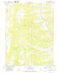
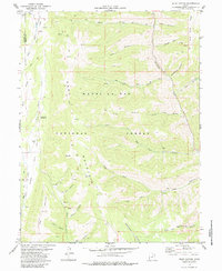
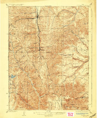
1979 Map of Rilda Canyon
USGS Topo · Published 1979About this map
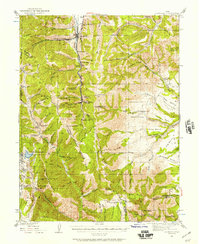
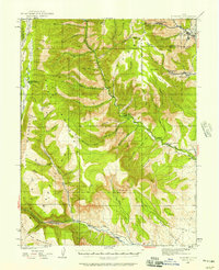
Manti-La Sal National Forest dominates this section of the Wasatch Plateau, where the boundary between Sanpete and Emery counties follows high ridges like Bald Ridge. The landscape is defined by a series of deep canyons and seasonal drainages, including Rilda Canyon, Crandall Canyon, and Horse Canyon, which carve through the high elevations. While much of the area remained protected forest land in the late 1970s, evidence of resource extraction and survey work appears in the form of multiple Drill Holes and scattered Mines along the canyon walls.
Find a feature on this map
52 named features on this map. Tap any name to fly to it.
Don’t see what you’re looking for? This feature index may not catch every label — zoom into the map to look around manually.
Map Details
Editions of this 1979 Rilda Canyon Map
2 editions found
Other maps of this area

1885 · Manti
USGS Topo · 1:250,000

1895 · Manti
USGS Topo · 1:250,000
1923 · Scofield
USGS Topo · 1:62,500
1923 · Hiawatha
USGS Topo · 1:62,500
1925 · Scofield
USGS Topo · 1:62,500

1925 · Hiawatha
USGS Topo · 1:62,500

1956 · Price
USGS Topo · 1:250,000

1960 · Price
USGS Topo · 1:250,000

1962 · Price
USGS Topo · 1:250,000
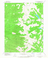
1965 · Huntington Reservoir
USGS Topo · 1:24,000