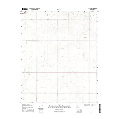
2017 Map of Riley Camp
USGS Topo · Published 2017About this map
Rte 66 cuts across the northern edge of this high plains landscape, following a drainage divide north of the San Jon Cr system. The terrain is defined by a series of south-running arroyos, including Arroyo Trujillo and Arroyo Saladito, which reveal a landscape centered on ranching and water management. Sparse but significant human markers such as Riley Camp and the evocatively named Boot Hill Cem provide evidence of the area's rural history. Numerous named water sources, from Alamo Spring to livestock infrastructure like Walker Tank and Allen Tank, illustrate the essential nature of water rights and ranch improvements in Quay County. The map provides a detailed view of the sectional grid system and the network of local routes like Quay Road M that connect these remote outposts.
Find a feature on this map
25 named features on this map. Tap any name to fly to it.
Don’t see what you’re looking for? This feature index may not catch every label — zoom into the map to look around manually.
Map Details
Editions of this 2017 Riley Camp Map
This is the sole edition of this map. No revisions or reprints were ever made.
Other maps of this area

1954 · Tucumcari
USGS Topo · 1:250,000

1954 · Clovis
USGS Topo · 1:250,000

1958 · Clovis
USGS Topo · 1:250,000

1958 · Tucumcari
USGS Topo · 1:250,000

1968 · Porter
USGS Topo · 1:24,000

1968 · Rock Camp
USGS Topo · 1:24,000

1968 · Riley Camp
USGS Topo · 1:24,000

1968 · San Jon
USGS Topo · 1:24,000

1968 · Bard
USGS Topo · 1:24,000

1968 · Glenrio
USGS Topo · 1:24,000