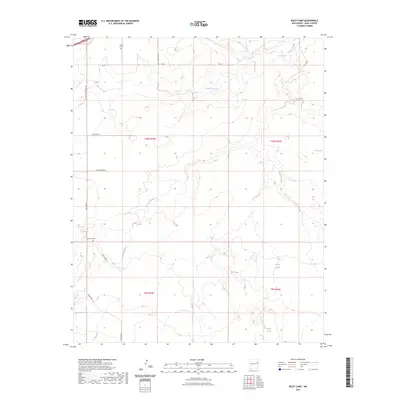
2023 Map of Riley Camp
USGS Topo · Published 2023About this map
San Jon Creek and Arroyo Trujillo carve their paths through this stretch of eastern New Mexico, defining a landscape of arid drainages and seasonal water sources. The map's northern edge is bisected by the historic path of Rte 66, a route synonymous with 20th-century American migration and travel. Local history is anchored by the presence of Bard Cem and the evocatively named Boot Hill Cem, which mark the resting places of early settlers in this ranching country. The reliance on water management is evident through numerous named catchments such as Walker Tank, Creek Tank, and Allen Tank, alongside natural features like Alamo Spring and Llano Spring. These features, along with a grid of rural thoroughfares like Quay Road K and Quay Road 54, illustrate the spatial organization of contemporary life and land use in Quay County.
Find a feature on this map
25 named features on this map. Tap any name to fly to it.
Don’t see what you’re looking for? This feature index may not catch every label — zoom into the map to look around manually.
Map Details
Editions of this 2023 Riley Camp Map
This is the sole edition of this map. No revisions or reprints were ever made.
Other maps of this area

1954 · Tucumcari
USGS Topo · 1:250,000

1954 · Clovis
USGS Topo · 1:250,000

1958 · Clovis
USGS Topo · 1:250,000

1958 · Tucumcari
USGS Topo · 1:250,000

1968 · Porter
USGS Topo · 1:24,000

1968 · Rock Camp
USGS Topo · 1:24,000

1968 · Riley Camp
USGS Topo · 1:24,000

1968 · San Jon
USGS Topo · 1:24,000

1968 · Bard
USGS Topo · 1:24,000

1968 · Glenrio
USGS Topo · 1:24,000