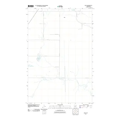
2010 Map of Riley
USGS Topo · Published 2010About this map
The West Swan River meanders across this northern St. Louis County landscape, defining the local hydrology of the Riley area. The settlement of Riley is surrounded by a structured grid of rural roads, many bearing names that likely reflect early 20th-century family homesteads or local landowners, such as Gust Erickson Rd, Anderson Rd, and Labarge Rd. This survey captures the rural character of the Iron Range region, highlighting several bodies of water including Harriett Lake and Little Harriett Lake. The map reveals a transition from these glacial lake features to the systematic road networks of Town Line Rd and S Town Line Rd, illustrating how modern infrastructure has integrated with the natural waterways and wetlands of the Minnesota northwoods.
Find a feature on this map
17 named features on this map. Tap any name to fly to it.
Don’t see what you’re looking for? This feature index may not catch every label — zoom into the map to look around manually.
Map Details
Editions of this 2010 Riley Map
This is the sole edition of this map. No revisions or reprints were ever made.
Other maps of this area

1951 · Hibbing
USGS Topo · 1:24,000

1951 · Buhl
USGS Topo · 1:24,000

1952 · Keewatin
USGS Topo · 1:24,000

1952 · Riley
USGS Topo · 1:24,000

1952 · Silica
USGS Topo · 1:24,000

1952 · Little Swan
USGS Topo · 1:24,000

1954 · Hibbing
USGS Topo · 1:250,000

1957 · Hibbing
USGS Topo · 1:250,000

1957 · Hibbing
USGS Topo · 1:24,000

1958 · Hibbing
USGS Topo · 1:250,000