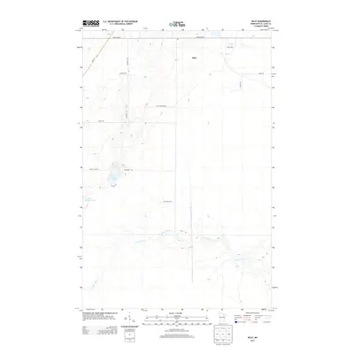
2013 Map of Riley
USGS Topo · Published 2013About this map
The W Swan River meanders across the southern reaches of this Saint Louis County landscape, defining the local drainage system near the settlement of Riley. This area of the Iron Range backcountry is characterized by a sparse road network often named for early local families, including A Matson Rd, Gust Erickson Rd, and Billings Rd. These paths navigate a terrain dotted with small glacial water bodies such as Harriett Lake and Little Harriett Lake. The prevalence of named local roads suggests a history of rural homesteads and land divisions that survived into the early 21st century. The map provides a clear view of the transition between developed township lines, like Town Line Rd, and the natural lowlands surrounding the river, offering a primary record of the region's topography before more recent environmental or infrastructural changes.
Find a feature on this map
16 named features on this map. Tap any name to fly to it.
Don’t see what you’re looking for? This feature index may not catch every label — zoom into the map to look around manually.
Map Details
Editions of this 2013 Riley Map
This is the sole edition of this map. No revisions or reprints were ever made.
Other maps of this area

1951 · Hibbing
USGS Topo · 1:24,000

1951 · Buhl
USGS Topo · 1:24,000

1952 · Keewatin
USGS Topo · 1:24,000

1952 · Riley
USGS Topo · 1:24,000

1952 · Silica
USGS Topo · 1:24,000

1952 · Little Swan
USGS Topo · 1:24,000

1954 · Hibbing
USGS Topo · 1:250,000

1957 · Hibbing
USGS Topo · 1:250,000

1957 · Hibbing
USGS Topo · 1:24,000

1958 · Hibbing
USGS Topo · 1:250,000